Bangladesh Navy
Hydrographic & Oceanographic Center

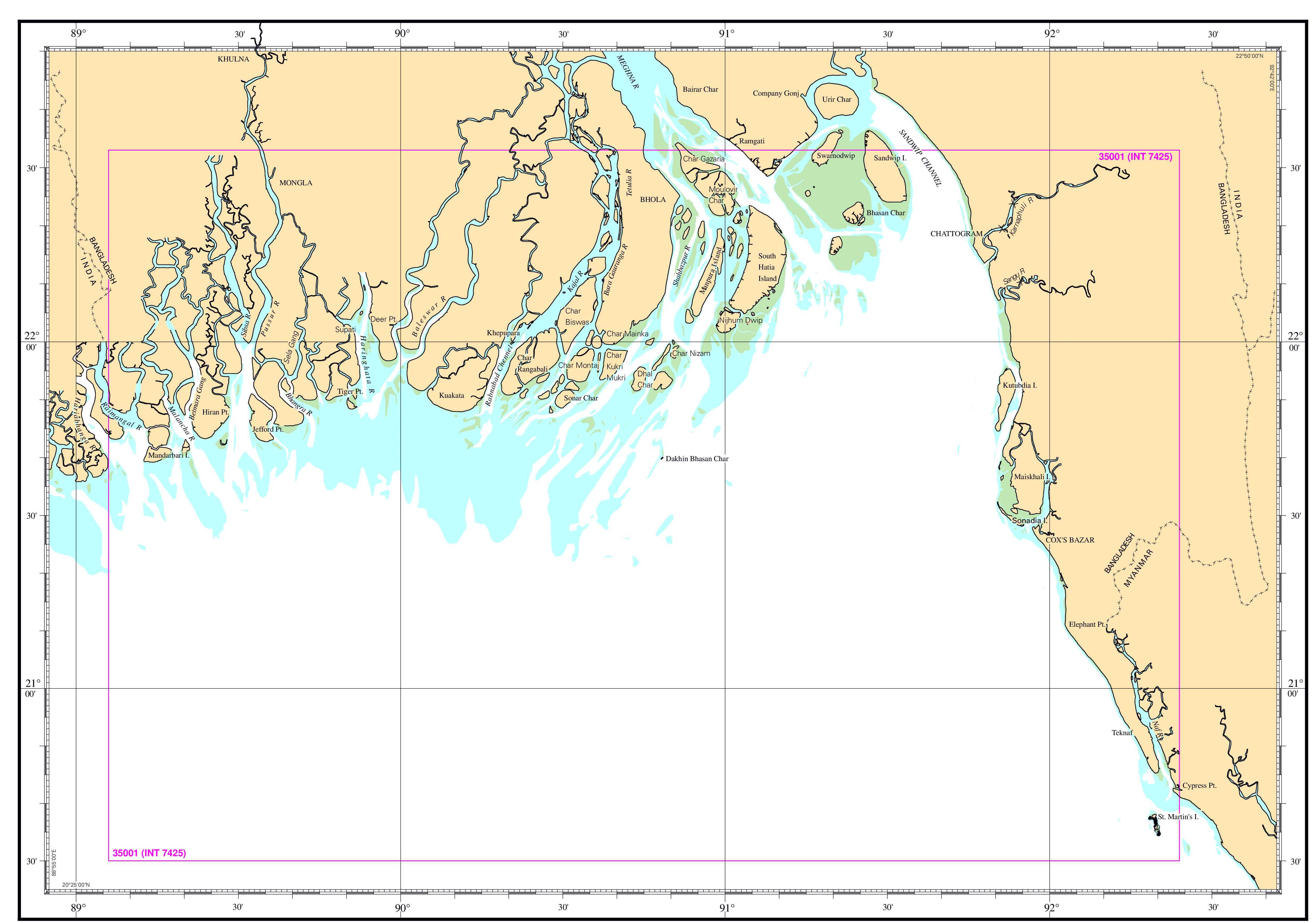
| Chart No. | 35001 (INT 7425) |
|---|---|
| Title | Malancha River to St. Martin’s Island |
| Geographic Location | Bay of Bengal |
| North Latitude | 22°33.00'N |
| South Latitude | 20°30.00'N |
| East Longitude | 092°24.00'E |
| West Longitude | 089°06.00'E |
| Scale | 1: 350 000 |
| Projection | Mercator |
| Date of Publication | 2010-08-26 |
| Edition No | 2 |
| Edition Date | 2017-02-02 |